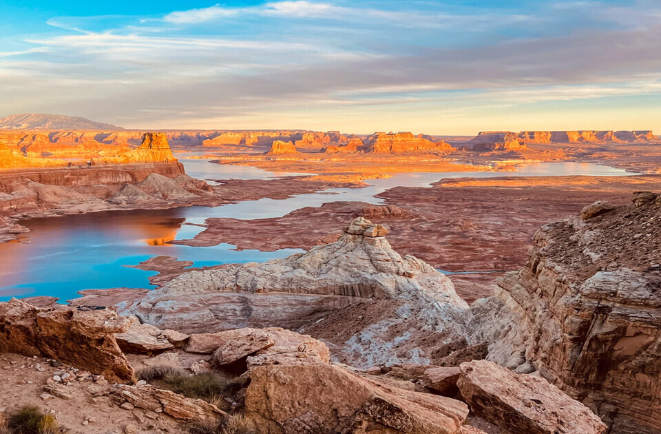

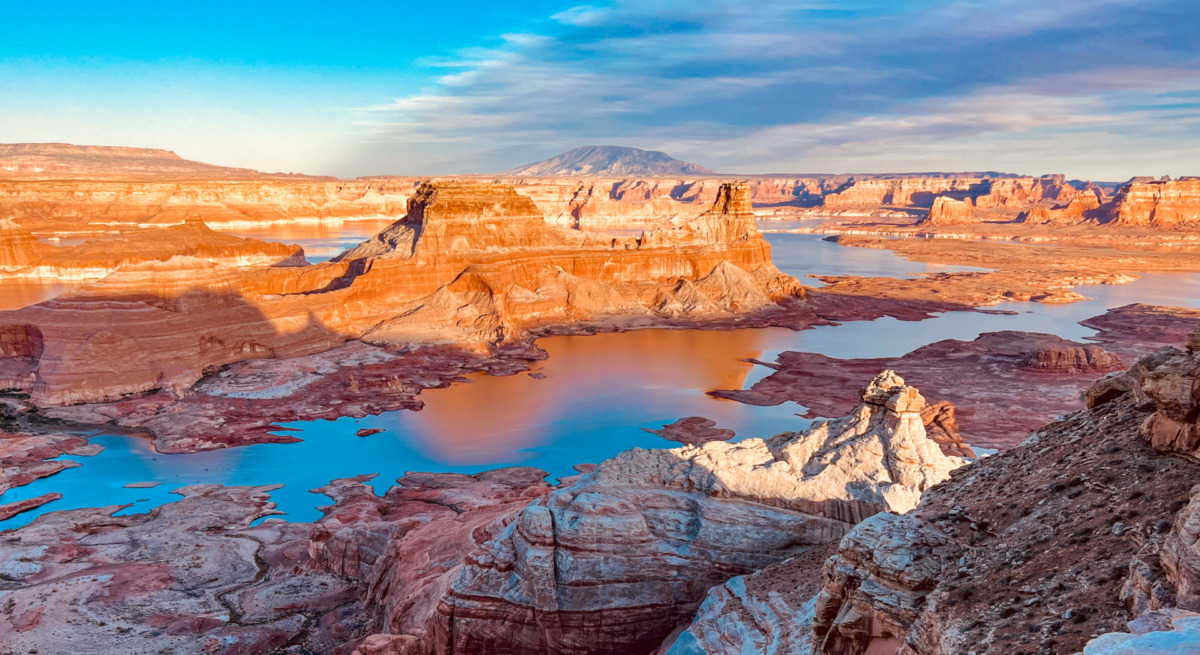
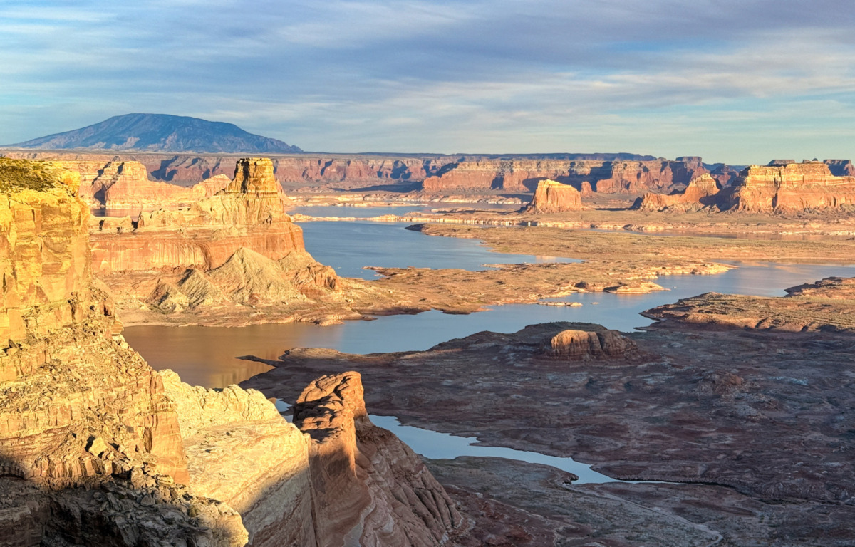
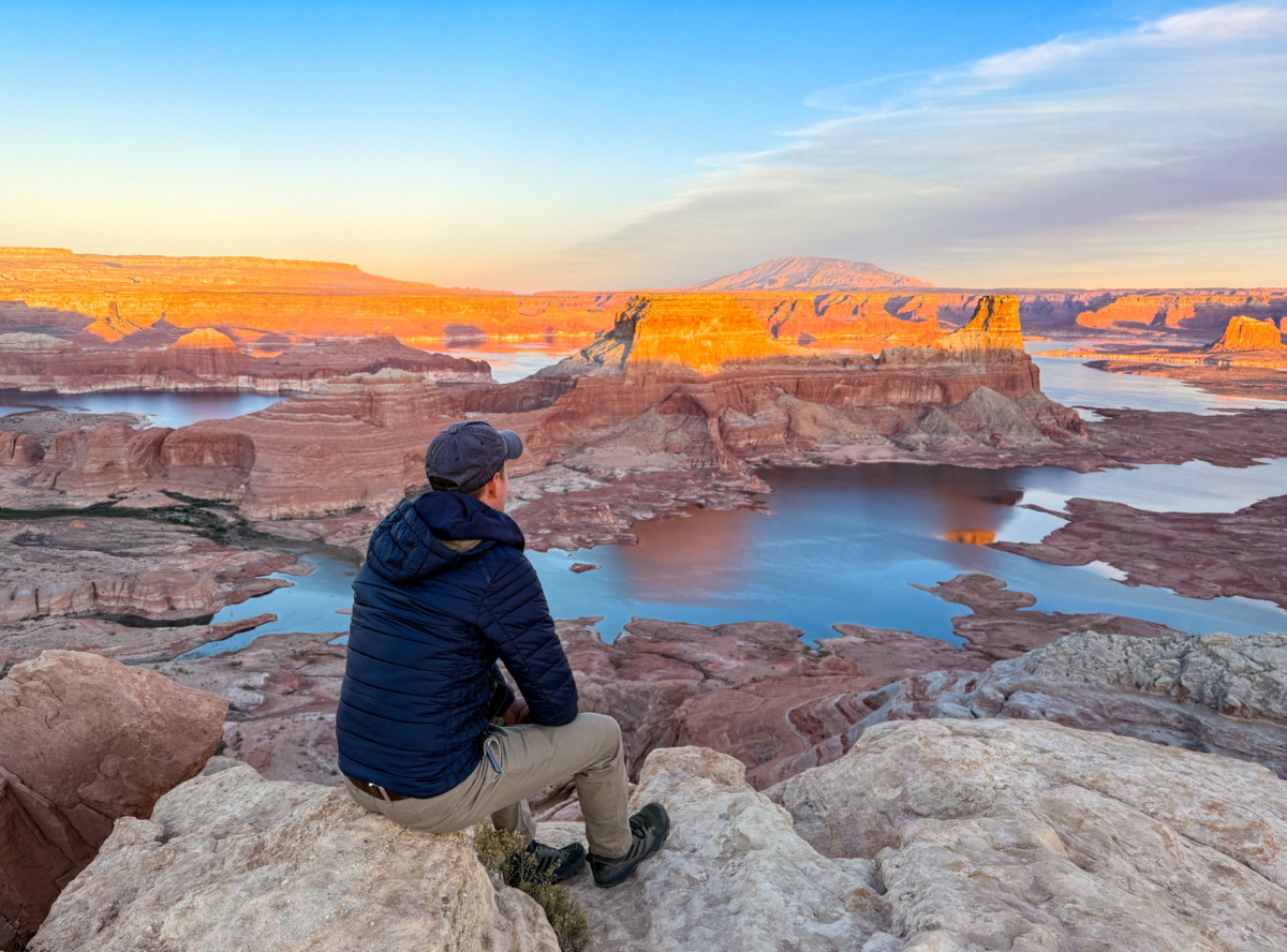
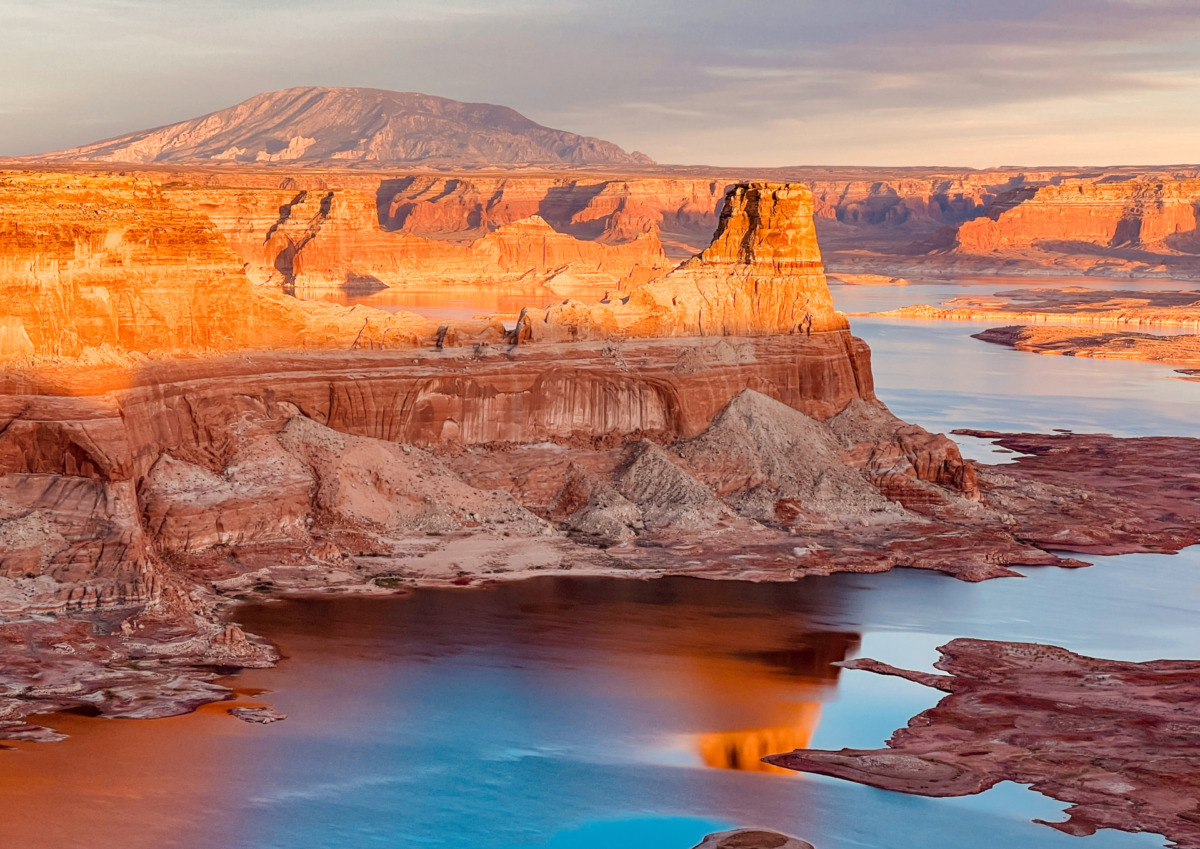
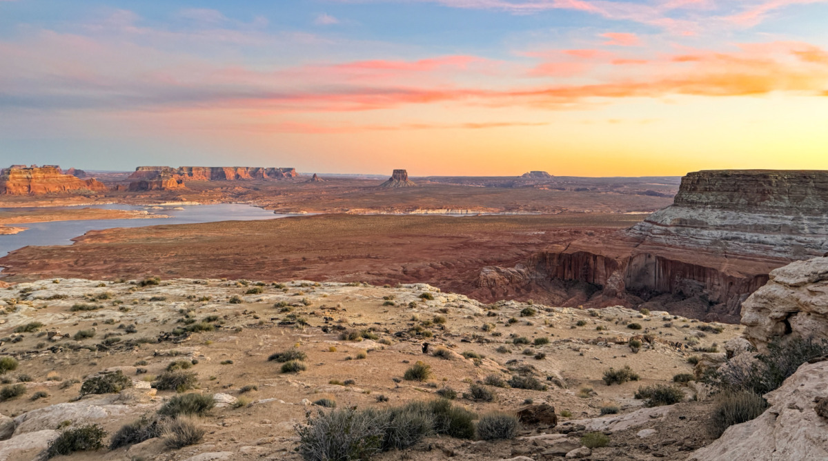
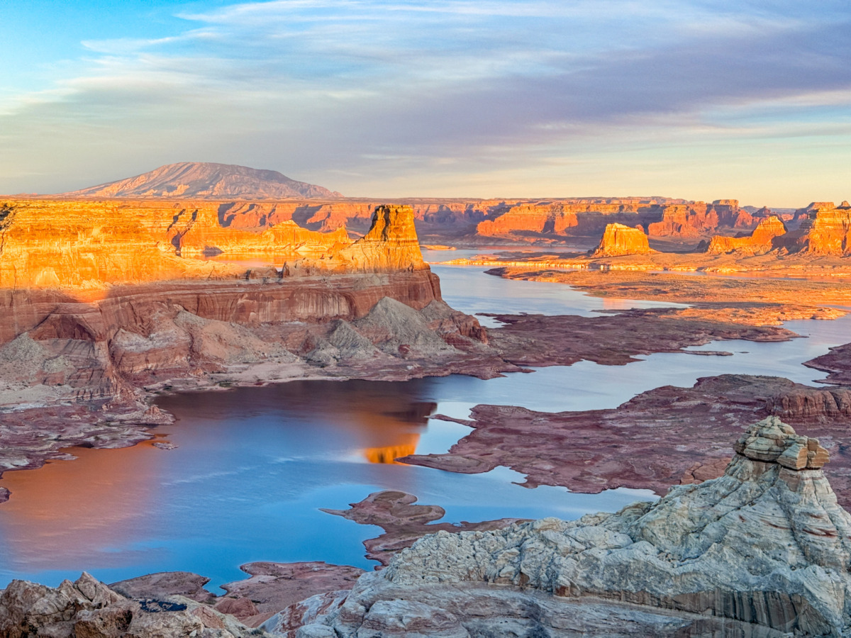
Alstrom Point is one of the most unique hidden gems in the USA. It is a stunning viewpoint in Utah that offers breathtaking panoramic views of Lake Powell and its scenic bays.
For those who love nature, adventure, and incredible landscapes, this is a must-visit destination on an American Southwest road trip. The journey is not easy, but the views are absolutely worth the effort. The red cliffs, deep blue water, and endless peace create a truly special experience for anyone who visits.
Ready for a trip to Page, Arizona?
Here are some quick recommendations on what to book for your trip:
Best places to stay:
Best things to do:
Since this is a rare and less-known viewpoint, we have created a detailed guide to provide all the information you need for your visit to Alstrom Point. We share important details about the route, necessary preparations, and the best time to go. You’ll also find useful tips on choosing the right vehicle, accommodation options, and potential challenges.
So if you are planning to go to Alstrom Point, read this guide to prepare for your trip and make the most of your adventure.
Is Alstrom Point in Utah worth visiting?
Yes, visiting Alstrom Point is absolutely worth it! It is not easy to reach, and in most cases, not cheap either, but there are very few viewpoints like this in the world. The unique view, the peaceful atmosphere, and the amazing surroundings make it a must-see if you are near Lake Powell.
Where is Alstrom Point located
Alstrom Point is located in southern Utah, near the Arizona border, overlooking the northwestern shores of Lake Powell.
From this point, you can enjoy stunning views of Gunsight Bay, located nearby, and the more distant Padre Bay.
It is one of the best spots to take in the beauty of the lake and its dramatic surroundings.
How to get to Alstrom Point
Reaching Alstrom Point is quite challenging, so thorough preparation is essential.
In the following sections, we will go over everything you need to know about getting there.
Best route to Alstrom Point
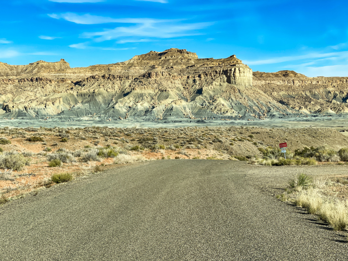
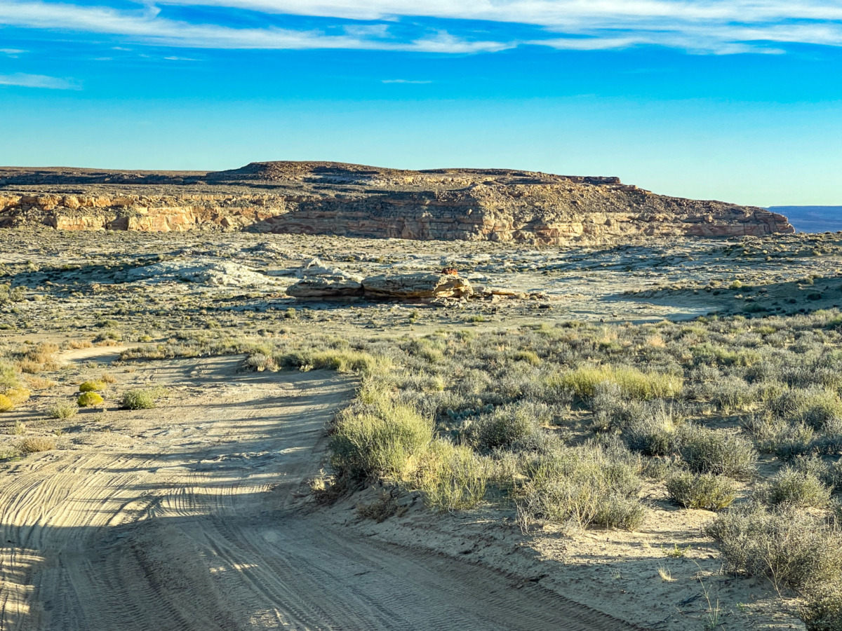
Alstrom Point can be reached via a single main route, which you should follow to get there. While the road may branch off into smaller sections in some places, this is the only practical route available.
It is important to plan this route in advance. Save it, take a photo, or even print it so you have an offline version. Your last mobile internet connection will be in Page or, at best, Big Water. Most mobile providers do not offer internet in this remote area.
Our suggested route starts from Page, the nearest city to Lake Powell.
The road is a total of 42.3 miles (68 km) and takes about 2 hours to drive one way.
Directions from Page to Alstrom Point:
- From Page, take Highway 89 North.

- Cross the Glen Canyon Dam Bridge, then continue driving until you reach Big Water.
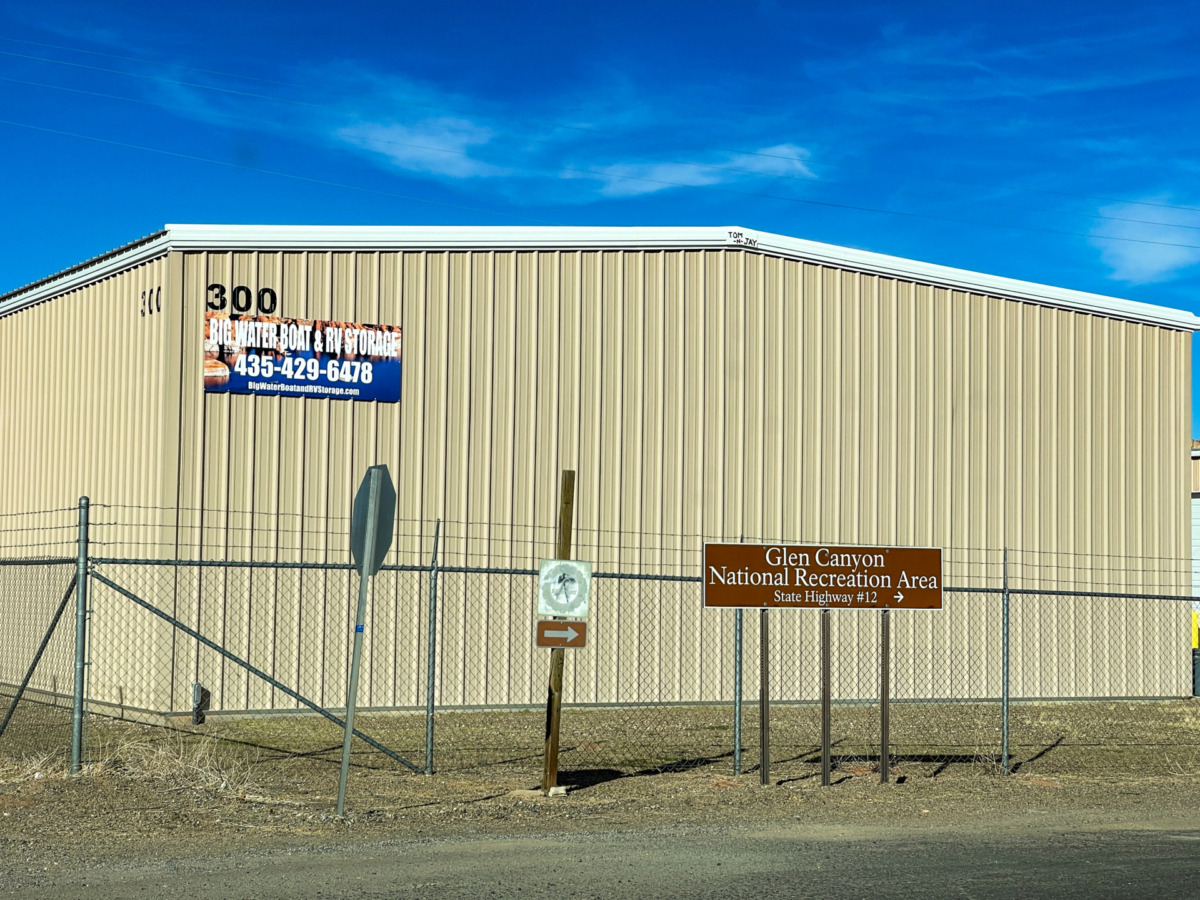
- Once in Big Water, turn right onto Ethan Allen Road.
- Shortly after passing All In Boat Rentals, turn right at the Glen Canyon National Recreation Area/State Highway #12 sign. From here, expect a dusty, gravel road all the way to the viewpoint.
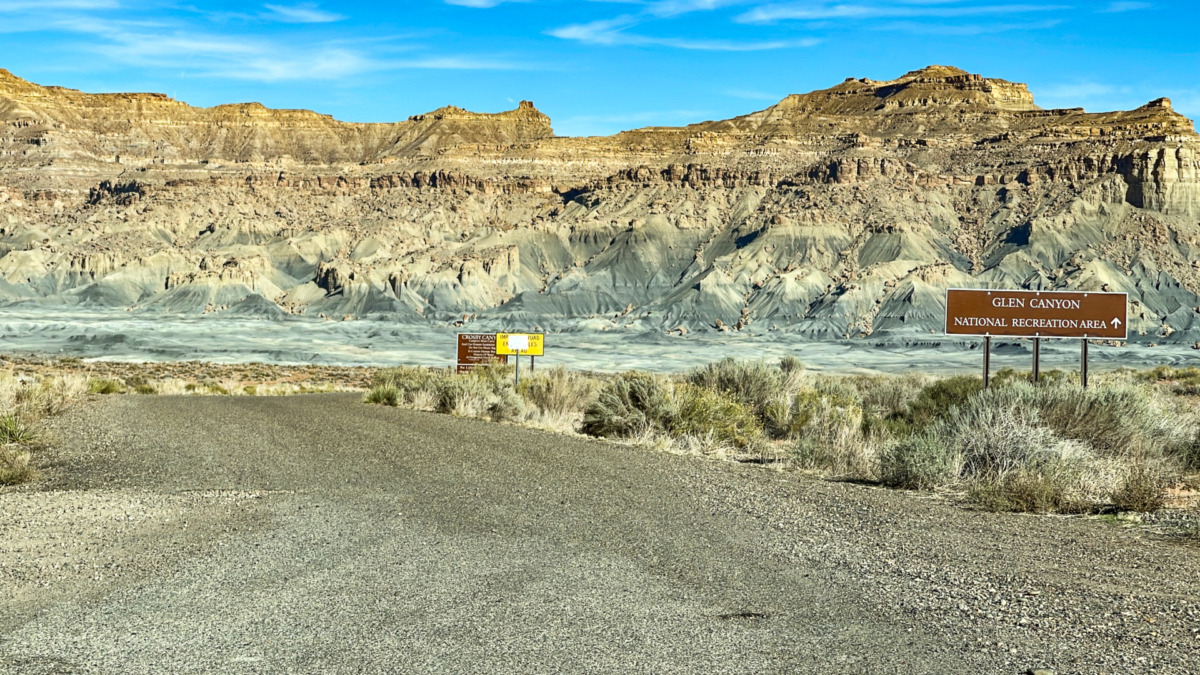
- You are now on Smokey Mountain Road (NP 230), which is a slightly winding, hilly, but well-maintained road. Follow this road for 13.7 miles (22 km).
- After 13.7 miles, turn right onto National Park Road 230 (K 8200).
- Continue for another 4.2 miles (6.8 km) on this road. Do not take the first right turn (Alstrom Point/Np 264), as that road is in much worse condition.
- After 4.2 miles, turn right onto Alstrom Point Access/Romana Mesard Road, where a sign marks the viewpoint. Although the sign states 5 miles, navigation systems indicate 7 miles (11.2 km) to the viewpoint. This road is labeled as Recreation Road 264 on Google Maps.
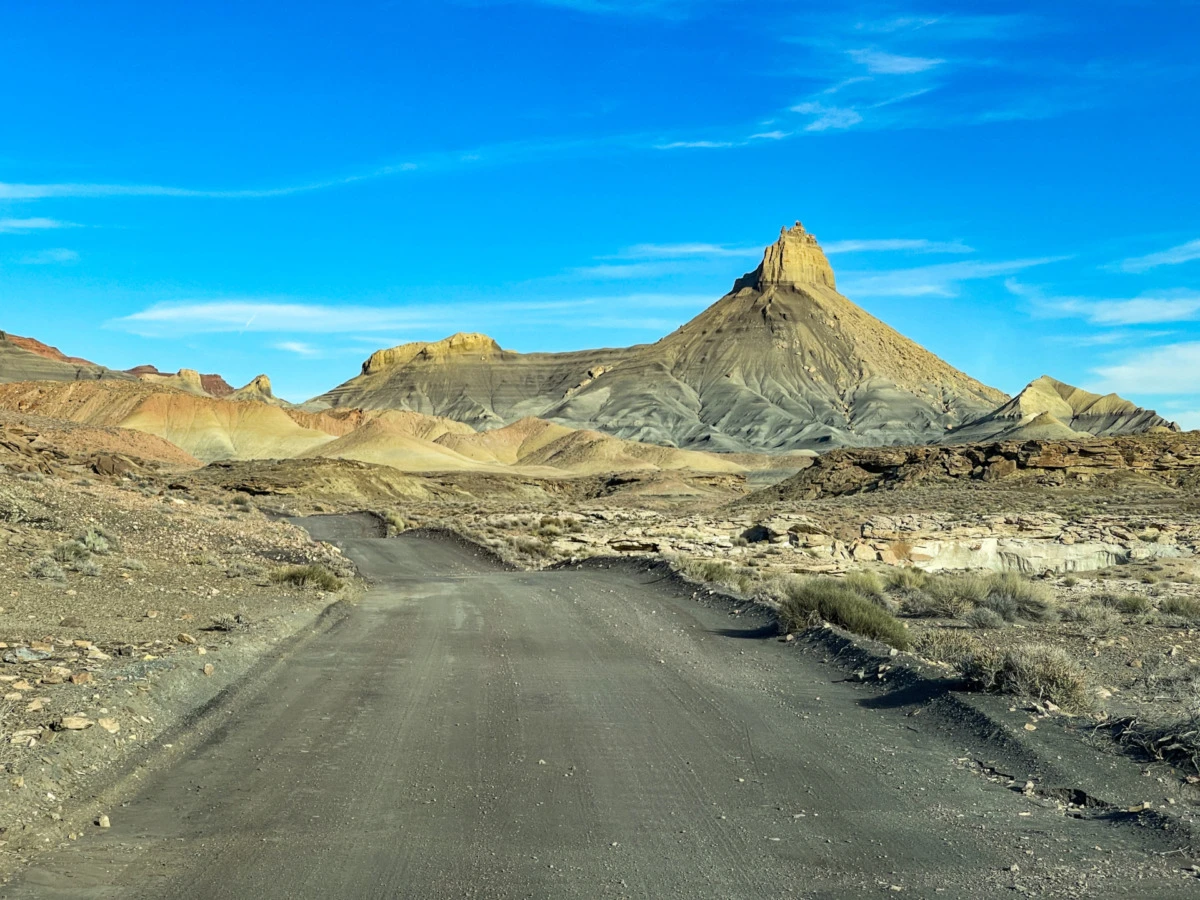
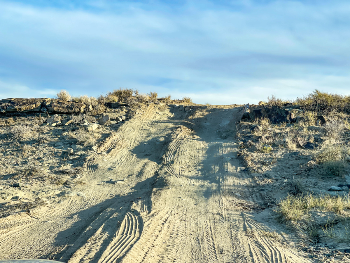
- The road becomes rougher as you approach Alstrom Point.
- Around 5 miles (8 km) in, expect very rough terrain, with potential obstacles that could scrape the bottom of your vehicle. The road often splits into multiple paths (2-4 directions), filled with large rocks and uneven ground.
- The last 2 miles (3.2 km) are particularly challenging, even for experienced drivers.
- If you are unsure about the correct path at any junction, stick to the most well-traveled route.
At the end of the road, you will arrive at Alstrom Point, recognizable by its breathtaking views and possibly other vehicles parked there.
How difficult is driving the road to Alstrom Point?
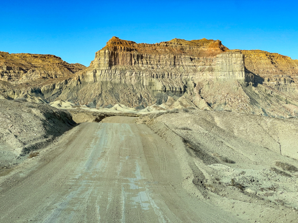
The road to Alstrom Point is a paved, high-quality road until Big Water.
However, after Big Water, the road continues for about 25 miles (40 km) to the viewpoint, and this entire stretch is dusty, gravel-covered, hilly, and winding.
As you get closer to Alstrom Point, the road conditions get worse, and some sections are challenging to drive on.
Yes, the last few miles are difficult, even for experienced drivers.
Overall, driving this route is moderate, with some difficult sections.
That’s why it’s important to plan your trip carefully and be well-prepared before you go.
Is the road to Alstrom Point possible without a 4WD car?
Some people say that a regular car with 2WD is enough until the last two miles.
But how will you cover the final stretch? Unless you are willing to hike the final two miles, you are taking a risk by relying on a standard car for the whole trip.
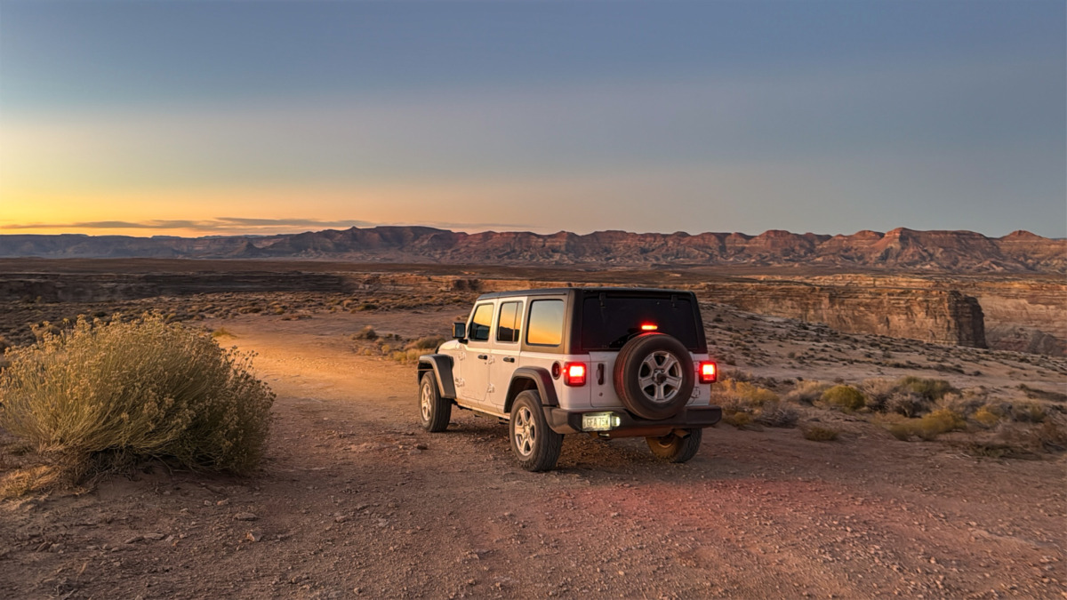
We are experienced drivers who travel a lot by car, and in our opinion, renting a 4×4 vehicle is the best option if you can afford it. It’s not cheap—expect to pay $250-$400 per day—but it makes the trip to Alstrom Point much safer and more comfortable.
If you don’t rent a 4WD, use a simple SUV with high clearance and know when to stop and park before the terrain gets too rough. Otherwise, you could get stuck or damage your tires on the final section.
For our 2024 visit to Alstrom Point, we rented a Jeep in Page from Jeepbnb Jeep Rentals. It was expensive, but we felt much safer than we would have with a regular SUV. And we didn’t regret it—driving to Alstrom Point is not easy!
How much time to plan for visiting Alstrom Point
Although the distance is just over 42 miles, the drive takes nearly 2 hours in one direction. This means a round trip takes 3.5 to 4 hours, plus the time you spend at the viewpoint.
In total, plan for at least 5–6 hours, but you may need even more time depending on road conditions and how long you want to stay.
What to bring for the trip
Since visiting Alstrom Point takes a long time, it’s important to prepare well in advance.
Make sure to bring the following:
- spare tire in case of a flat
- enough food and water (not just snacks)
- fully charged phones and offline maps
- the route saved or photographed for offline access
Where to stay near Lake Powell
Alstrom Point is closest to Page, Arizona, which is the best place to find accommodation near Lake Powell.
Here are some recommended options:
- Country Inn & Suites by Radisson, Page, AZ: This was our personal choice in Page. It’s a three-star hotel in the mid-price range with a great location.
- Wingate by Wyndham Page Lake Powell: Another three-star hotel with a great location and slightly lower prices.
FAQ about visiting Alstrom Point
Here are some quick answers to common questions about visiting Alstrom Point:
What dangers can you face when visiting Alstrom Point?
- Rain: Always check the weather before your trip. Do not go if it has recently rained or if rain is expected. The road can become muddy and very difficult or even impossible to drive on. In some areas, flash floods are also possible.
- Extreme heat or cold: In summer, bring plenty of water to stay hydrated. In winter, wear warm clothing to protect yourself from the cold.
- Car trouble (like a flat tire): Be prepared for possible car issues, such as a flat tire or breakdown. If you stay on the main road, you may meet other travelers who can help, but it’s best to be as prepared as possible.
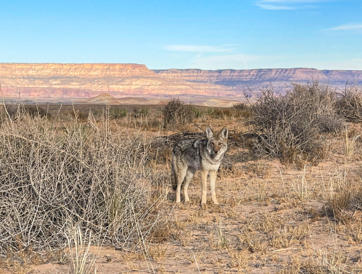
- Wildlife: There are not many dangerous animals, but remember that predators can be in the area. We personally saw a coyote on the way. You may also encounter snakes, so stay aware of your surroundings.
- Mobile signal: As mentioned, you may not have cell service or GPS signal on the way. Be prepared with offline maps, photos, and a saved route before you go.
- Fuel: There are no gas stations along the route, so fill up your tank in Page or at the latest in Big Water.
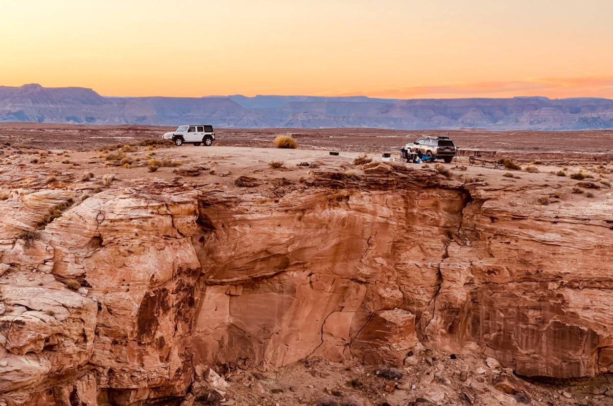
Can you camp at Alstrom Point?
Yes, you can camp at Alstrom Point, and it is actually a relatively popular activity there.
You can book an organized camping tour or camp on your own.
However, because of the wildlife, we would think twice about using a tent, as it could be a bit risky.
A 4×4 camper or a well-equipped off-road vehicle where you can sleep would be a great option.
Do you need a permit or entry ticket for the overlook?
No, you do not need any permits or entrance fees for the viewpoint or the road leading to it. Everything is completely free.
Best time to visit Alstrom Point
The best seasons to visit are spring and fall, as you can avoid the extreme summer heat and winter cold.
Also, try to visit on a weekday for a quieter and more peaceful experience.
The best time of day to visit Alstrom Point is a good question, and the answer is quite subjective.
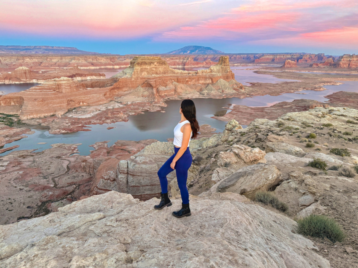
We chose to go in the late afternoon and stay for sunset, and it was a great decision.
Many people spend the entire night there, which allows them to see both sunset and sunrise.
Which is better for visiting: sunrise or sunset?
We picked sunset because the light and colors were amazing. Most of the landscape visible from the viewpoint is east of Alstrom Point, so the setting sun in the west provides better lighting for the scenery.
The downside of visiting at sunset is that rental prices for off-road vehicles are higher if you return them late.
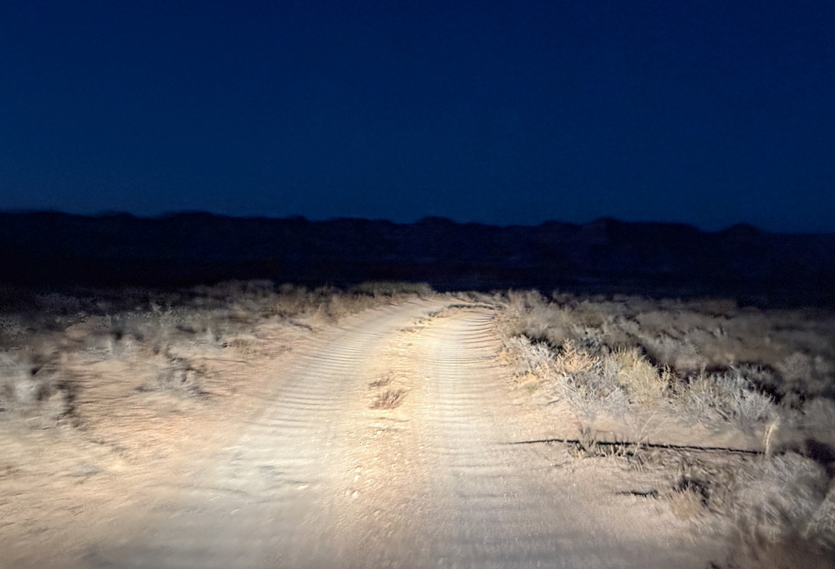
Also, if you are not staying overnight at Alstrom Point, you will have to drive back in the dark. We did this, and while it was manageable, it’s best suited for experienced drivers with a proper off-road vehicle.
Many people also love sunrise, which is easiest to catch if you camp overnight at the viewpoint. At sunrise, you will also see unique lighting effects, but the sun will be shining directly into your eyes.
Are there hiking trails near Alstrom Point?
You are free to hike anywhere in the area, but there are no marked trails. The terrain is rocky, with steep cliffs and no infrastructure, so it is not an ideal place for regular hiking.
Other attractions in the area
The area around Lake Powell have many amazing sights close to each other.
Here are some of the most interesting ones:
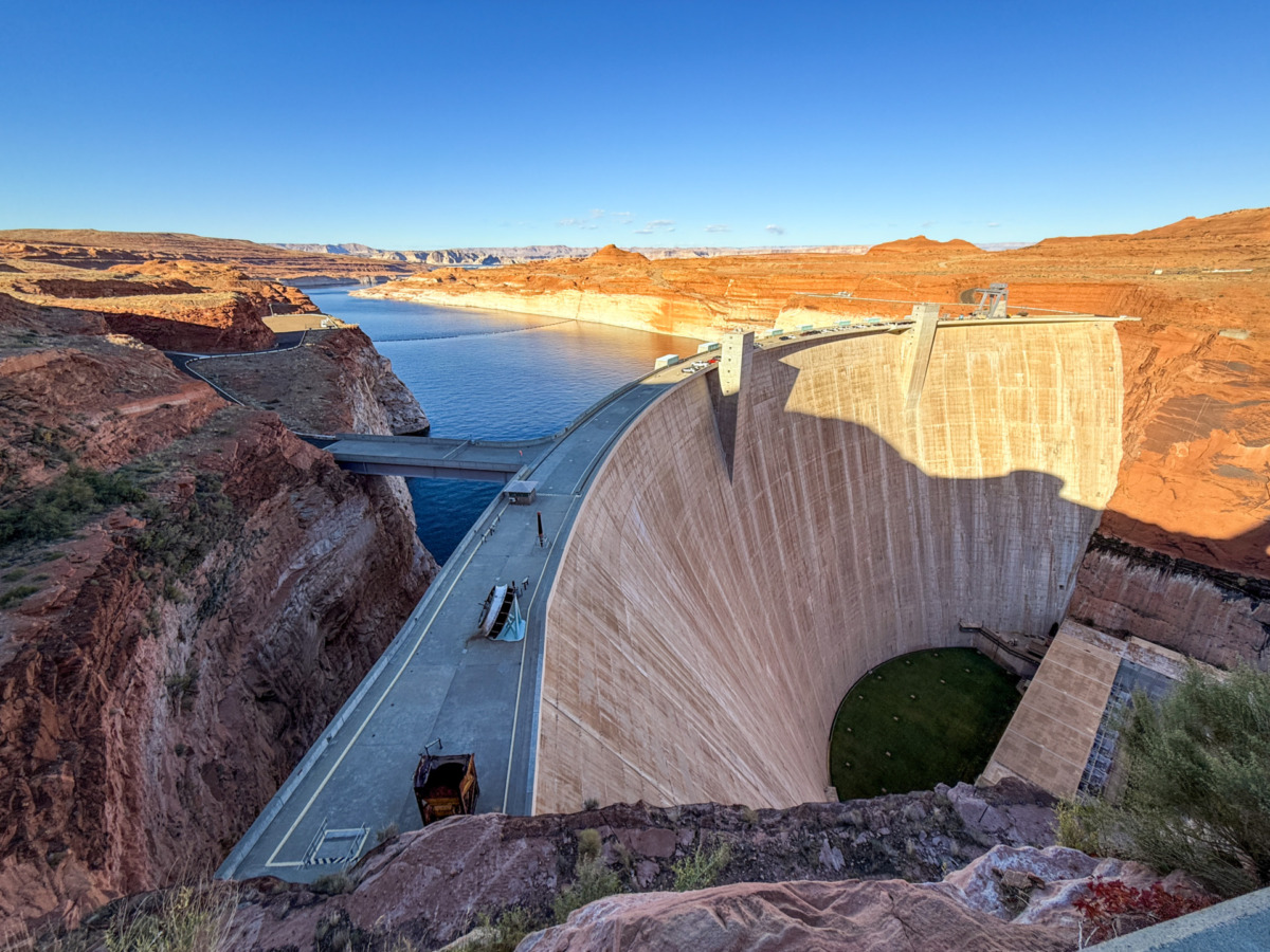
Glen Canyon Dam
The Glen Canyon Dam is a massive concrete dam on the Colorado River, located near Page, Arizona.
It was completed in the 1960s, creating Lake Powell to provide hydroelectric power and water storage for the region.
If you’re traveling on Highway 89, it’s worth stopping at the Carl Hayden Visitor Center, located right next to the dam. Here, you can find exhibits about the dam’s history, construction, and environmental impact.
This visitor center also offers the best viewpoint of the dam, making it a great place for a stop.
Horseshoe Bend
The world-famous Horseshoe Bend is also located near Page, Arizona.
This iconic, horseshoe-shaped canyon is easy to reach with a one-time parking fee and a short walk along a dusty trail to the viewpoint.
It is one of the most photographed natural formations in the USA, making it a must-see if you’re in the area.
Don’t forget to bring a wide-angle camera, as the canyon is much bigger than it looks in photos.

Antelope Canyon
Antelope Canyon, located in Page, Arizona, is about a 2.5-hour drive from both Zion and the Grand Canyon, making it a great choice for a day trip.
This famous slot canyon has two sections: Upper Antelope Canyon and Lower Antelope Canyon. Our favorite is the Lower Antelope Canyon, but both are very popular and worth visiting.
A guided tour is required for both sections, so it’s a good idea to book your tickets in advance.

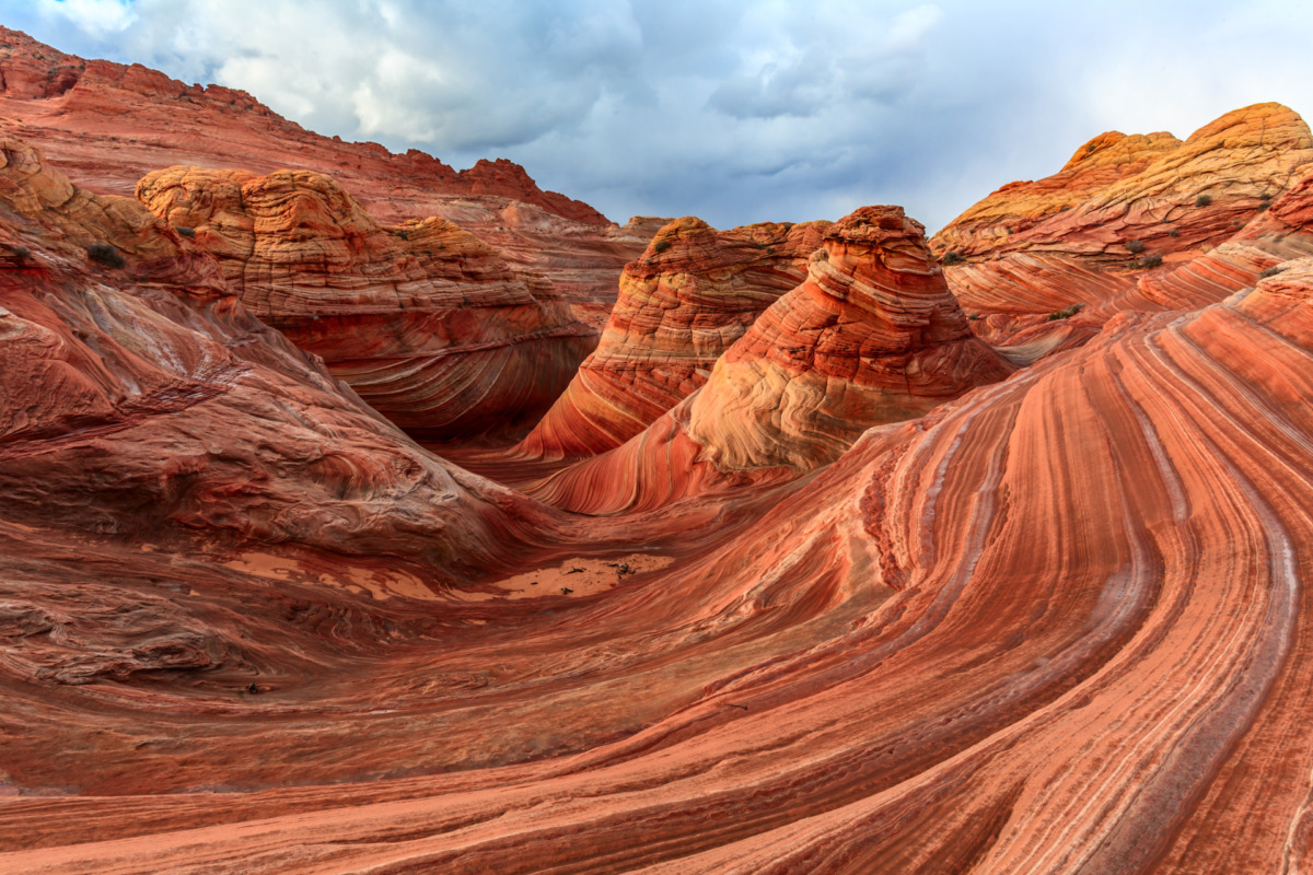
The Wave
The Wave is a stunning and unique sandstone rock formation located in Vermilion Cliffs National Monument, near the Arizona-Utah border. It is famous for its surreal, wave-like patterns and bright colors, making it one of the most photographed natural landmarks in the USA.
To visit The Wave, you need a special permit, which is very hard to get because the number of daily visitors is strictly limited. You must enter a lottery a few days before your planned visit, and there is a fee to apply. Unfortunately, getting a permit is not guaranteed.
If you are lucky enough to get a permit, the hike to The Wave is 6.4 miles (10.3 km) round trip and has challenging terrain, so good preparation is essential.
Alstrom Point is one of the best viewpoints in the Southwest. It is a special place where you can enjoy breathtaking views, amazing wildlife, an exciting drive, and incredible peace and quiet.
If you visit Page, we highly recommend spending an afternoon at Alstrom Point, watching a beautiful sunset, and experiencing this unique hidden gem.
It is important to prepare well for the trip, and we hope this guide has given you all the important information you need.
So if you are ready for an Alstrom Point adventure, get prepared and have a great trip!

Hi! I’m Adri, the creator of Traveltipzone.com and Italianwanderlust.com.
I’ve explored over 30 countries so far and travel to around 15 each year — some new places and others I love returning to. I’m especially passionate about Southern Europe, particularly Italy, and the United Arab Emirates.
Follow my journeys for firsthand travel tips and inspiration!